 Wayfarrow
Covered Bridge Farms Covered Bridge
Covered bridge · New Castle County, Delaware
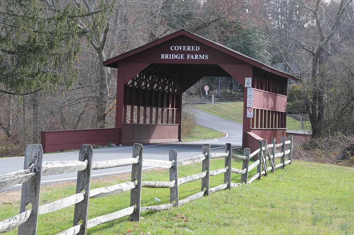
Covered Bridge Farms Covered Bridge is a covered bridge in New Castle County, Delaware. Delaware has 4 covered bridges on record at Wayfarrow, 4 of them in New Castle County.
It was built in 1961, in the postwar decades; it is about 39 feet long.
Status check, 2026-11: A non-authentic covered bridge, a cover on a concrete slab, at the entrance to the Covered Bridge Farms subdivision. It is not on the National Register. It stands at 39.7012° N, 75.7864° W.
Key facts
| Current structure built | 1961 |
|---|---|
| Length | 39 ft |
| Coordinates | 39.70115, -75.78639 |
Nearby places
- Foxcatcher Farm Covered Bridgecovered bridge · Cecil County · 2.8 mi
- Bankghost town · Cecil County · 3.6 mi
- Bel Hillghost town · Cecil County · 5.3 mi
- The Rockghost town · Cecil County · 5.3 mi
- Rudolph and Arthur Covered Bridgecovered bridge · Chester County · 6 mi
- Ewingvilleghost town · Cecil County · 6.4 mi
- Glen Hopeghost town · Chester County · 6.5 mi
- Glen Hope Covered Bridgecovered bridge · Chester County · 6.7 mi
- Linton Stephens Covered Bridgecovered bridge · Chester County · 7.7 mi
- Glenvilleghost town · New Castle County · 7.8 mi
- Nellys Cornerghost town · Cecil County · 8 mi
- Frenchtownghost town · Cecil County · 8.9 mi
Questions
Where is Covered Bridge Farms Covered Bridge?
Covered Bridge Farms Covered Bridge is in New Castle County, Delaware, at 39.7012, -75.7864.
How many covered bridges are in New Castle County?
New Castle County, Delaware has 4 covered bridges on record at Wayfarrow.
- Wikidata — Wikidata item (CC0)
- Wayfarrow status check (web sources) — Checked for current status (facts)
- Wayfarrow status check (web sources) — Checked for current status (facts)
- Wayfarrow status check (web sources) — Checked for current status (facts)

Facts marked "approximately" carry an uncertain date in the source. Text on this page is generated from the sources above; no encyclopedia prose is copied. Last updated 2026-11-05.