 Wayfarrow
Johnson Creek Covered Bridge
Covered bridge · Robertson County, Kentucky
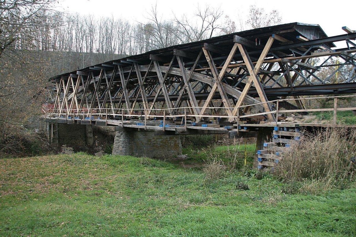
Johnson Creek Covered Bridge is a covered bridge in Robertson County, Kentucky. Kentucky has 15 covered bridges on record at Wayfarrow.
Status check, 2026-11: Smith truss by Jacob N. Bower, partly burned and rebuilt in 1910, now closed to traffic; most sources say 1874 but lostbridges says 1882, and lengths range from 110 to 131 ft, so both are left null. Johnson Creek Covered Bridge is listed on the National Register of Historic Places. It stands at 38.4811° N, 83.9769° W.
Key facts
| Heritage designation | National Register of Historic Places listed place |
|---|---|
| National Register | Listed |
| Coordinates | 38.48111, -83.97694 |
Nearby places
- Mount Pleasantghost town · Robertson County · 2.3 mi
- Five Lick Creekghost town · Robertson County · 2.3 mi
- Ogden Ridgeghost town · Robertson County · 2.4 mi
- Manleyghost town · Mason County · 4.5 mi
- Linvilleghost town · Robertson County · 6.8 mi
- Brierly Ridgeghost town · Robertson County · 7 mi
- Hickory Ridgeghost town · Nicholas County · 9.2 mi
- Dexterghost town · Mason County · 10.7 mi
- Oaklandghost town · Bracken County · 10.9 mi
- Parinaghost town · Bracken County · 11 mi
- Belmontghost town · Bracken County · 11.5 mi
- Asburyghost town · Bracken County · 13.3 mi
Sources and licences
- Wikidata — Wikidata item (CC0)
- National Register of Historic Places — National Register of Historic Places record (public-domain)
- Wikidata — Wikipedia article (linked as a source; text not used) (CC0)
- Wayfarrow status check (web sources) — Checked for current status (facts)
- Wayfarrow status check (web sources) — Checked for current status (facts)
- Wayfarrow status check (web sources) — Checked for current status (facts)
Facts marked "approximately" carry an uncertain date in the source. Text on this page is generated from the sources above; no encyclopedia prose is copied. Last updated 2026-11-05.