 Wayfarrow
Whittier Bridge
Covered bridge · Carroll County, New Hampshire
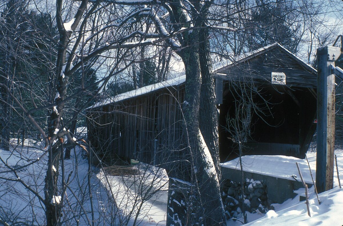
Whittier Bridge is a covered bridge in Carroll County, New Hampshire. New Hampshire has 51 covered bridges on record at Wayfarrow, 5 of them in Carroll County.
It crosses Bearcamp River.
Status check, 2026-11: This Paddleford truss bridge was built around 1870; it was taken off its abutments in 2008 and put back over the Bearcamp River in 2021, and reported lengths range from about 132 to 144 ft. Whittier Bridge is listed on the National Register of Historic Places. It stands at 43.8222° N, 71.2119° W.
Key facts
| Crosses | Bearcamp River |
|---|---|
| Heritage designation | National Register of Historic Places listed place |
| National Register | Listed |
| Coordinates | 43.82222, -71.21194 |
Nearby places
- Lords Hillghost town · Carroll County · 7.8 mi
- Durgin Bridgecovered bridge · Carroll County · 8 mi
- Saco River Bridgecovered bridge · Carroll County · 12.1 mi
- Swift River Bridgecovered bridge · Carroll County · 12.2 mi
- Albany Bridgecovered bridge · Carroll County · 12.8 mi
- Porter-Parsonfield Bridgecovered bridge · Oxford County · 13.8 mi
- Brownfield Covered Bridgecovered bridge · Oxford County · 18.8 mi
- Livermoreghost town · Grafton County · 19.3 mi
- Blair Bridgecovered bridge · Grafton County · 22.6 mi
- Hemlock Bridgecovered bridge · Oxford County · 23.5 mi
- Clark's Bridgecovered bridge · Grafton County · 28.5 mi
- Flume Covered Bridgecovered bridge · Grafton County · 30.1 mi
Questions
Where is Whittier Bridge?
Whittier Bridge is in Carroll County, New Hampshire, at 43.8222, -71.2119.
How many covered bridges are in Carroll County?
Carroll County, New Hampshire has 5 covered bridges on record at Wayfarrow.
- Wikidata — Wikidata item (CC0)
- National Register of Historic Places — National Register of Historic Places record (public-domain)
- Wikidata — Wikipedia article (linked as a source; text not used) (CC0)
- Wayfarrow status check (web sources) — Checked for current status (facts)
- Wayfarrow status check (web sources) — Checked for current status (facts)
- Wayfarrow status check (web sources) — Checked for current status (facts)
- Wayfarrow status check (web sources) — Checked for current status (facts)
Facts marked "approximately" carry an uncertain date in the source. Text on this page is generated from the sources above; no encyclopedia prose is copied. Last updated 2026-11-05.