 Wayfarrow
Newton Falls Covered Bridge (1856)
Covered bridge · Trumbull County, Ohio
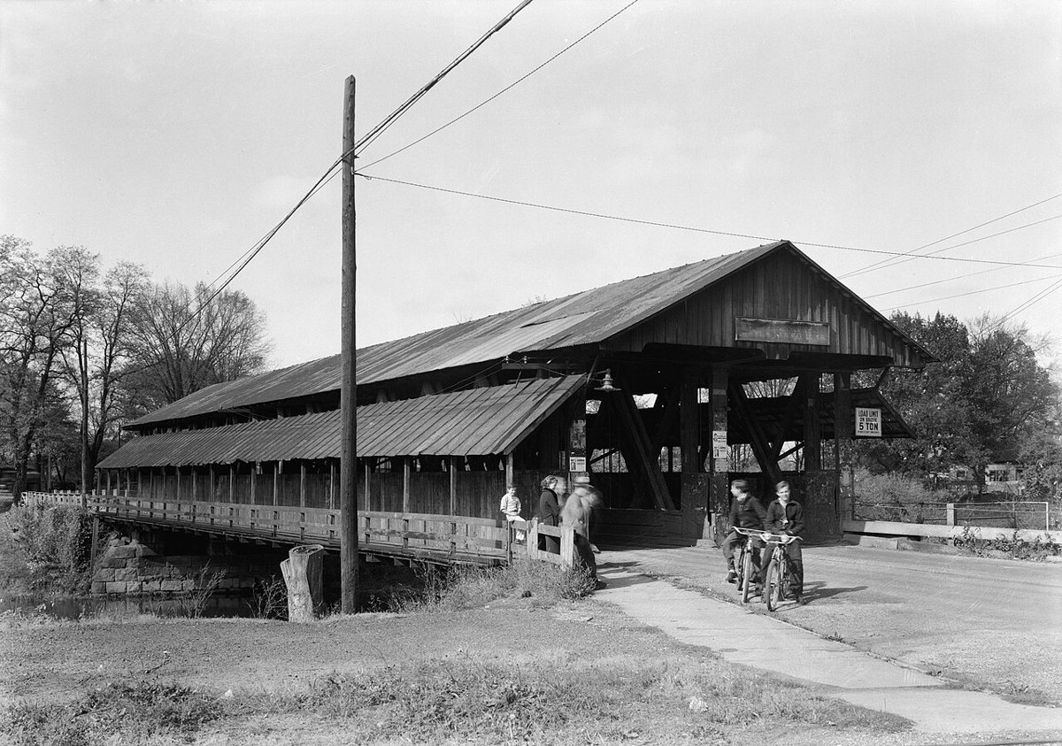
Newton Falls Covered Bridge (1856) is a covered bridge in Trumbull County, Ohio. Ohio has 147 covered bridges on record at Wayfarrow, 2 of them in Trumbull County.
It was built in 1831, in the first half of the 19th century, making it the 3rd oldest of the 75 in Ohio with a recorded construction date.
Status check, 2026-11: The record mixes up two bridges. The 1856 West Branch double covered bridge was torn down in 1942 and replaced with a concrete span. The bridge standing near these coordinates is the c.1831 East Branch (Arlington Blvd) bridge, NRHP 74001636, and its length is given as 123 ft or 117 ft. Newton Falls Covered Bridge (1856) is listed on the National Register of Historic Places. It stands at 41.1867° N, 80.9724° W.
Key facts
| Current structure built | 1831 |
|---|---|
| Heritage designation | National Register of Historic Places listed place |
| National Register | Listed |
| Coordinates | 41.18669, -80.97239 |
Nearby places
- Newton Falls Covered Bridge (1831)covered bridge · Trumbull County · 0.1 mi
- Harrisportghost town · Portage County · 2 mi
- Greenleafs Cornersghost town · Portage County · 7.1 mi
- East Davisghost town · Portage County · 8 mi
- Keansghost town · Portage County · 9.1 mi
- Ohltonghost town · Mahoning County · 11 mi
- Wassieghost town · Trumbull County · 11.8 mi
- Hutsonghost town · Portage County · 12 mi
- Boswellghost town · Mahoning County · 16.4 mi
- New Guineaghost town · Stark County · 18 mi
- Cobbs Cornersghost town · Portage County · 18.1 mi
- Juliaghost town · Geauga County · 18.7 mi
Questions
Where is Newton Falls Covered Bridge (1856)?
Newton Falls Covered Bridge (1856) is in Trumbull County, Ohio, at 41.1867, -80.9724.
How many covered bridges are in Trumbull County?
Trumbull County, Ohio has 2 covered bridges on record at Wayfarrow.
- Wikidata — Wikidata item (CC0)
- National Register of Historic Places — National Register of Historic Places record (public-domain)
- Wikidata — Wikipedia article (linked as a source; text not used) (CC0)
- Wayfarrow status check (web sources) — Checked for current status (facts)
- Wayfarrow status check (web sources) — Checked for current status (facts)
- Wayfarrow status check (web sources) — Checked for current status (facts)
- Wayfarrow status check (web sources) — Checked for current status (facts)
Facts marked "approximately" carry an uncertain date in the source. Text on this page is generated from the sources above; no encyclopedia prose is copied. Last updated 2026-11-05.