 Wayfarrow
Scottown Covered Bridge
Covered bridge · Lawrence County, Ohio
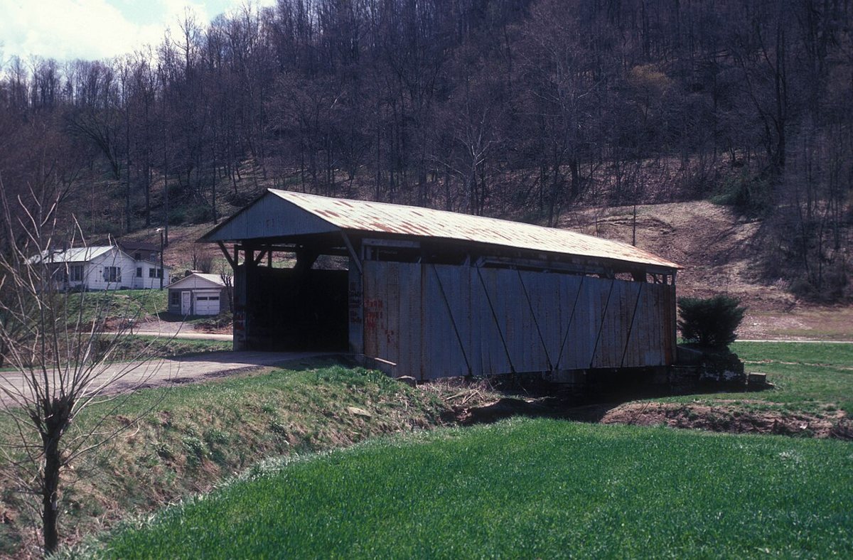
Scottown Covered Bridge is a covered bridge in Lawrence County, Ohio. Ohio has 147 covered bridges on record at Wayfarrow.
It crosses Indian Guyan Creek.
Status check, 2026-11: Last covered bridge in Lawrence County and the southernmost in Ohio; reported as rebuilt in 1991 and closed to traffic; sources give 1874 or 1877 as the build year and 79, 85 or 88 ft as the length. Scottown Covered Bridge is listed on the National Register of Historic Places. It stands at 38.5478° N, 82.3803° W.
Key facts
| Crosses | Indian Guyan Creek |
|---|---|
| Heritage designation | National Register of Historic Places listed place |
| National Register | Listed |
| Coordinates | 38.54778, -82.38028 |
Nearby places
- Idaghost town · Lawrence County · 2.8 mi
- Mankerghost town · Lawrence County · 7.7 mi
- Cherryvilleghost town · Lawrence County · 9.2 mi
- Rubyghost town · Gallia County · 9.4 mi
- Brownstownghost town · Cabell County · 9.8 mi
- Halleyghost town · Gallia County · 10.9 mi
- Clemmaghost town · Gallia County · 11.3 mi
- Montrealghost town · Lawrence County · 11.6 mi
- Moodyghost town · Gallia County · 11.7 mi
- Hollisghost town · Gallia County · 12.3 mi
- Johns Creekghost town · Lawrence County · 13.3 mi
- Boggsghost town · Gallia County · 13.7 mi
Sources and licences
- Wikidata — Wikidata item (CC0)
- National Register of Historic Places — National Register of Historic Places record (public-domain)
- Wikidata — Wikipedia article (linked as a source; text not used) (CC0)
- Wayfarrow status check (web sources) — Checked for current status (facts)
- Wayfarrow status check (web sources) — Checked for current status (facts)
- Wayfarrow status check (web sources) — Checked for current status (facts)
Facts marked "approximately" carry an uncertain date in the source. Text on this page is generated from the sources above; no encyclopedia prose is copied. Last updated 2026-11-05.