 Wayfarrow
West Liberty Covered Bridge
Covered bridge · Ashtabula County, Ohio
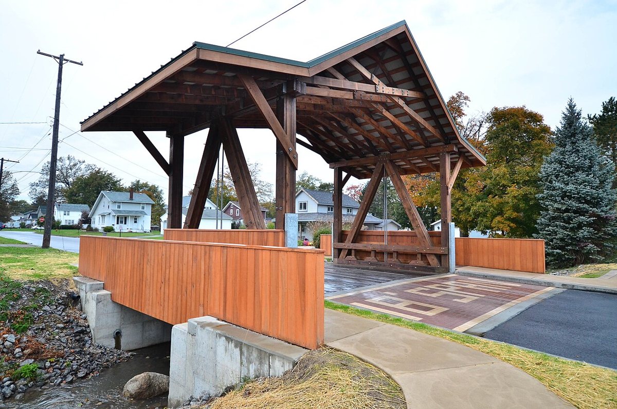
West Liberty Covered Bridge is a covered bridge in Ashtabula County, Ohio, described in its record as bridge in Ohio. Ohio has 147 covered bridges on record at Wayfarrow, 18 of them in Ashtabula County.
It stands at 41.7991° N, 80.9485° W.
Nearby places
- Harpersfield Covered Bridgecovered bridge · Ashtabula County · 3 mi
- Mechanicsville Road Covered Bridgecovered bridge · Ashtabula County · 4 mi
- Madison Dockghost town · Lake County · 4.7 mi
- Wheelerghost town · Lake County · 6.7 mi
- Calmghost town · Geauga County · 8 mi
- Doyle Road Covered Bridgecovered bridge · Ashtabula County · 8.5 mi
- Barnes Cornersghost town · Ashtabula County · 8.6 mi
- Riverdale Road Covered Bridgecovered bridge · Ashtabula County · 9.6 mi
- Smolen–Gulf Bridgecovered bridge · Ashtabula County · 10.4 mi
- Ashtabula Harbor Lightlighthouse · Ashtabula County · 11.4 mi
- Giddings Road Covered Bridgecovered bridge · Ashtabula County · 11.4 mi
- South Thompsonghost town · Geauga County · 11.6 mi
Questions
Where is West Liberty Covered Bridge?
West Liberty Covered Bridge is in Ashtabula County, Ohio, at 41.7991, -80.9485.
How many covered bridges are in Ashtabula County?
Ashtabula County, Ohio has 18 covered bridges on record at Wayfarrow.
Sources and licences
- Wikidata — Wikidata item (CC0)
- Wikidata — Wikipedia article (linked as a source; text not used) (CC0)
Facts marked "approximately" carry an uncertain date in the source. Text on this page is generated from the sources above; no encyclopedia prose is copied. Last updated 2026-11-05.