 Wayfarrow
Rock O' the Range Bridge
Covered bridge · Deschutes County, Oregon
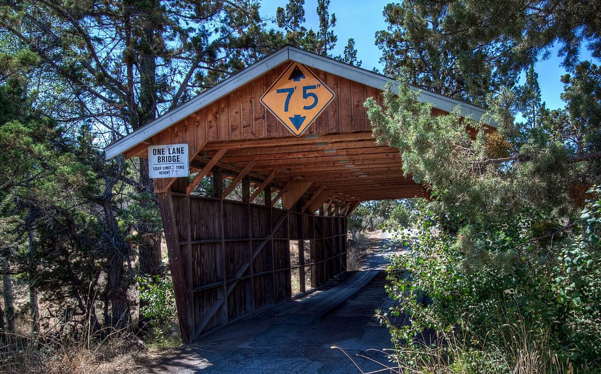
Rock O' the Range Bridge is a covered bridge in Deschutes County, Oregon, described in its record as historic bridge in Oregon, USA. Oregon has 57 covered bridges on record at Wayfarrow, 2 of them in Deschutes County.
It was built in 1963, in the postwar decades, making it the 37th oldest of the 41 in Oregon with a recorded construction date.
Status check, 2026-11: Private roofed bridge over the Swalley Canal, NRHP-listed under Oregon Covered Bridges. Since it has no supporting truss, the World Guide doesn't count it as a true covered bridge; only one source gives a length (42 ft). Rock O' the Range Bridge is listed on the National Register of Historic Places. It stands at 44.1231° N, 121.2853° W.
Key facts
| Current structure built | 1963 |
|---|---|
| Heritage designation | National Register of Historic Places listed place |
| National Register | Listed |
| Coordinates | 44.12306, -121.28528 |
Nearby places
- Hixon Crossing Covered Bridgecovered bridge · Deschutes County · 6 mi
- Cline Fallsghost town · Deschutes County · 10.5 mi
- Lower Bridgeghost town · Deschutes County · 16.4 mi
- Genevaghost town · Jefferson County · 24.8 mi
- Millicanghost town · Deschutes County · 24.8 mi
- Lamontaghost town · Jefferson County · 26.9 mi
- Belknap Bridgecovered bridge · Lane County · 46.9 mi
- Imperialghost town · Deschutes County · 49.4 mi
- Ashwoodghost town · Jefferson County · 49.7 mi
Questions
Where is Rock O' the Range Bridge?
Rock O' the Range Bridge is in Deschutes County, Oregon, at 44.1231, -121.2853.
How many covered bridges are in Deschutes County?
Deschutes County, Oregon has 2 covered bridges on record at Wayfarrow.
- Wikidata — Wikidata item (CC0)
- National Register of Historic Places — National Register of Historic Places record (public-domain)
- Wikidata — Wikipedia article (linked as a source; text not used) (CC0)
- Wayfarrow status check (web sources) — Checked for current status (facts)
- Wayfarrow status check (web sources) — Checked for current status (facts)
- Wayfarrow status check (web sources) — Checked for current status (facts)
Facts marked "approximately" carry an uncertain date in the source. Text on this page is generated from the sources above; no encyclopedia prose is copied. Last updated 2026-11-05.