 Wayfarrow
Northfield Falls Covered Bridge
Covered bridge · Washington County, Vermont
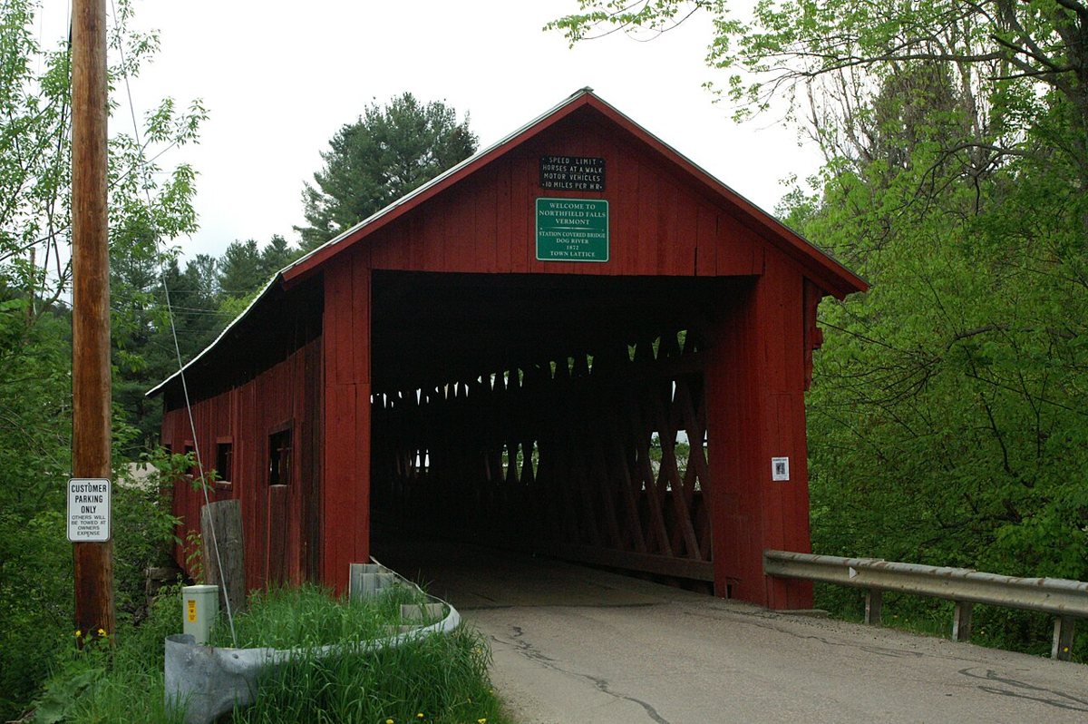
Northfield Falls Covered Bridge is a covered bridge in Washington County, Vermont, described in its record as bridge in Northfield, Vermont. Vermont has 91 covered bridges on record at Wayfarrow, 11 of them in Washington County.
It was built in 1872, in the late 19th century, making it the 21st oldest of the 57 in Vermont with a recorded construction date; it is about 137 feet long (7th longest of 46 measured in Vermont).
Status check, 2026-11: Also called the Station Covered Bridge, this Town lattice bridge has a concrete center pier and had steel beams added underneath in 1963. It is the only place in Vermont where you can see one covered bridge through the portal of another. Northfield Falls Covered Bridge is listed on the National Register of Historic Places. It stands at 44.1725° N, 72.6511° W.
Key facts
| Current structure built | 1872 |
|---|---|
| Length | 137 ft |
| Heritage designation | National Register of Historic Places listed place |
| National Register | Listed |
| Coordinates | 44.17250, -72.65111 |
Nearby places
- Lower Cox Brook Covered Bridgecovered bridge · Washington County · 0.1 mi
- Upper Cox Brook Covered Bridgecovered bridge · Washington County · 0.2 mi
- Slaughter House Covered Bridgecovered bridge · Washington County · 0.3 mi
- Stony Brook Covered Bridgecovered bridge · Washington County · 4.1 mi
- Pine Brook Covered Bridgecovered bridge · Washington County · 7.4 mi
- Great Eddy Covered Bridgecovered bridge · Washington County · 8.6 mi
- Robbins Nest Covered Bridgecovered bridge · Washington County · 9 mi
- Warren Covered Bridgecovered bridge · Washington County · 11.1 mi
- Coburn Covered Bridgecovered bridge · Washington County · 12.3 mi
- Martin Covered Bridgecovered bridge · Washington County · 14.4 mi
- Braley Covered Bridgecovered bridge · Orange County · 17.5 mi
- Moxley Covered Bridgecovered bridge · Orange County · 17.6 mi
Questions
Where is Northfield Falls Covered Bridge?
Northfield Falls Covered Bridge is in Washington County, Vermont, at 44.1725, -72.6511.
How many covered bridges are in Washington County?
Washington County, Vermont has 11 covered bridges on record at Wayfarrow.
- Wikidata — Wikidata item (CC0)
- National Register of Historic Places — National Register of Historic Places record (public-domain)
- Wikidata — Wikipedia article (linked as a source; text not used) (CC0)
- Wayfarrow status check (web sources) — Checked for current status (facts)
- Wayfarrow status check (web sources) — Checked for current status (facts)
- Wayfarrow status check (web sources) — Checked for current status (facts)
- Wayfarrow status check (web sources) — Checked for current status (facts)
Facts marked "approximately" carry an uncertain date in the source. Text on this page is generated from the sources above; no encyclopedia prose is copied. Last updated 2026-11-05.