 Wayfarrow
Meems Bottom Covered Bridge
Covered bridge · Shenandoah County, Virginia
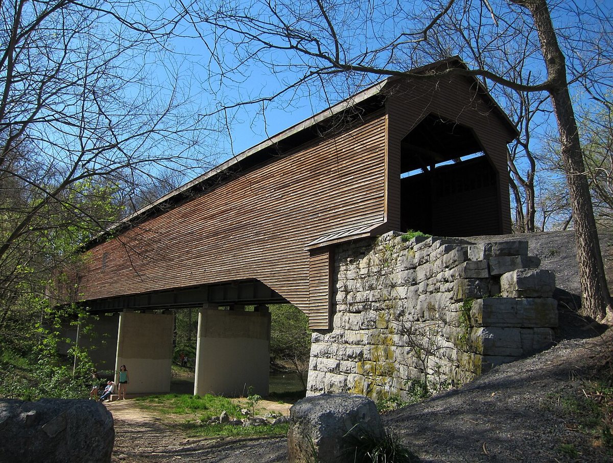
Meems Bottom Covered Bridge is a covered bridge in Shenandoah County, Virginia, described in its record as place in Virginia listed on National Register of Historic Places. Virginia has 8 covered bridges on record at Wayfarrow.
It is about 204 feet long.
Status check, 2026-11: Built around 1892–94 (sources give different years). Arsonists burned it on Halloween 1976, and it was rebuilt from the salvaged original timbers, with steel beams and concrete piers added. It reopened to traffic in 1978 or 1979 (sources differ). Meems Bottom Covered Bridge is listed on the National Register of Historic Places. It stands at 38.7206° N, 78.6556° W.
Key facts
| Length | 204 ft |
|---|---|
| Heritage designation | Virginia Historic Landmark |
| National Register | Listed |
| Coordinates | 38.72060, -78.65560 |
Nearby places
- Red Banksghost town · Shenandoah County · 6.3 mi
- Paulingtonghost town · Rockingham County · 17.7 mi
- Old Furnaceghost town · Rockingham County · 18.8 mi
- Oldragghost town · Madison County · 20.8 mi
- Furnaceghost town · Hardy County · 21.8 mi
- Peach Groveghost town · Rockingham County · 25.6 mi
- Almondghost town · Rockingham County · 26.7 mi
- Fabiusghost town · Hardy County · 27.6 mi
- Downingghost town · Warren County · 28.1 mi
- Domanghost town · Hardy County · 28.2 mi
- Seemlyghost town · Grant County · 28.3 mi
- Hiserghost town · Grant County · 29.9 mi
- Wikidata — Wikidata item (CC0)
- National Register of Historic Places — National Register of Historic Places record (public-domain)
- Wikidata — Wikipedia article (linked as a source; text not used) (CC0)
- Wayfarrow status check (web sources) — Checked for current status (facts)
- Wayfarrow status check (web sources) — Checked for current status (facts)
- Wayfarrow status check (web sources) — Checked for current status (facts)
- Wayfarrow status check (web sources) — Checked for current status (facts)
Facts marked "approximately" carry an uncertain date in the source. Text on this page is generated from the sources above; no encyclopedia prose is copied. Last updated 2026-11-05.