 Wayfarrow
Sarvis Fork Covered Bridge
Covered bridge · Jackson County, West Virginia
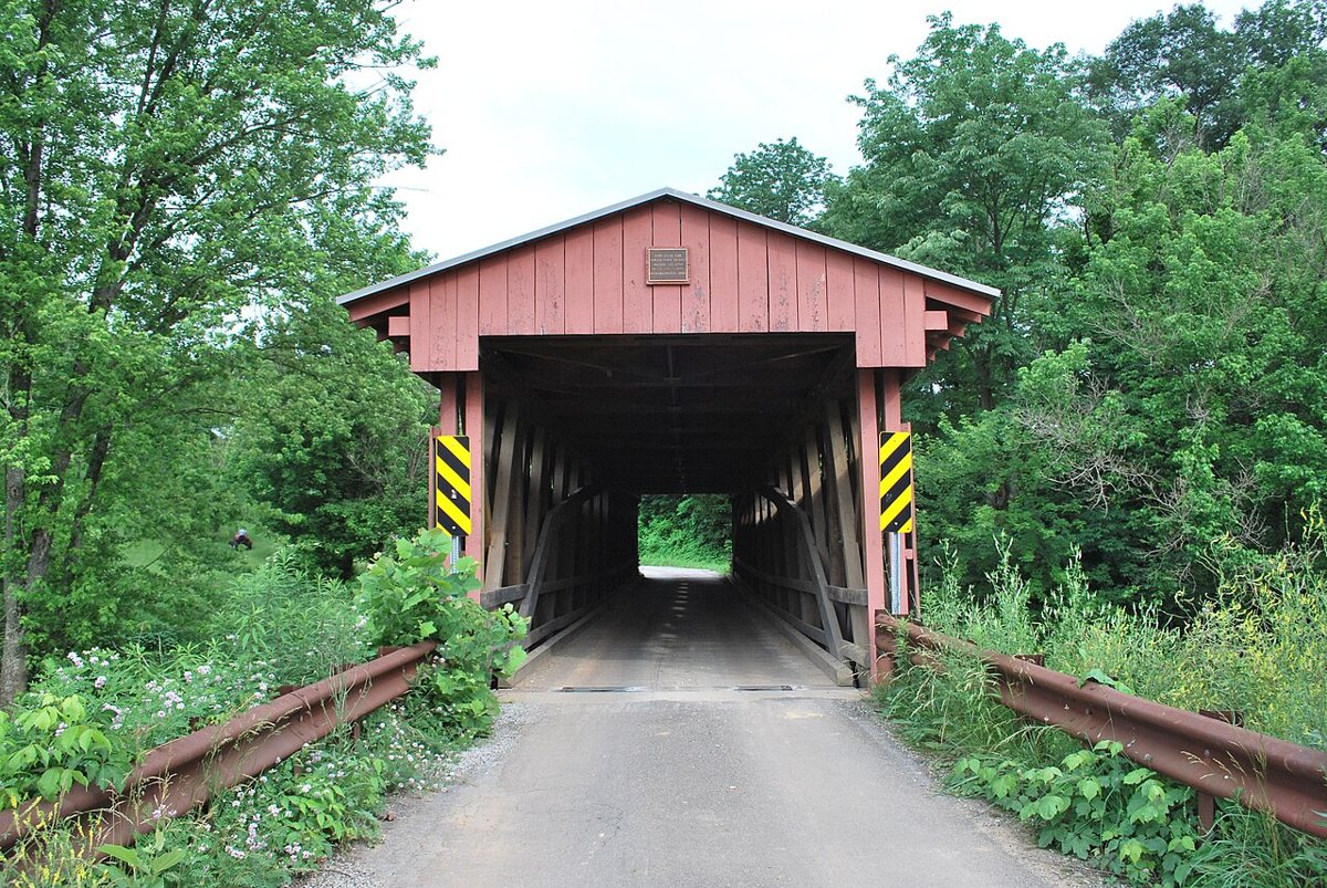
Sarvis Fork Covered Bridge is a covered bridge in Jackson County, West Virginia. West Virginia has 22 covered bridges on record at Wayfarrow, 2 of them in Jackson County.
It is about 101 feet long (5th longest of 11 measured in West Virginia).
Status check, 2026-11: Long truss bridge finished in 1889–1890 (sources give different years) on Mill Creek's Carnahan Fork, moved to the Left Fork of Sandy Creek in 1924, heavily rebuilt in 2000, and still open to traffic; WVDOT gives the length as 101.25 ft. Sarvis Fork Covered Bridge is listed on the National Register of Historic Places. It stands at 38.9214° N, 81.6447° W.
Key facts
| Length | 101 ft |
|---|---|
| Heritage designation | National Register of Historic Places listed place |
| National Register | Listed |
| Coordinates | 38.92140, -81.64470 |
Nearby places
- Mentorghost town · Jackson County · 4.8 mi
- Nesselroadghost town · Jackson County · 5.7 mi
- Browningghost town · Jackson County · 7.2 mi
- Beatysvilleghost town · Jackson County · 8.1 mi
- Mozelleghost town · Jackson County · 8.6 mi
- Buffaloghost town · Jackson County · 8.8 mi
- Staats Mill Covered Bridgecovered bridge · Jackson County · 9.1 mi
- Willow Groveghost town · Jackson County · 10.3 mi
- Eldenghost town · Meigs County · 10.4 mi
- Runkleghost town · Jackson County · 10.6 mi
- Powersghost town · Wood County · 12.1 mi
- McKinleyghost town · Wood County · 12.1 mi
Questions
Where is Sarvis Fork Covered Bridge?
Sarvis Fork Covered Bridge is in Jackson County, West Virginia, at 38.9214, -81.6447.
How many covered bridges are in Jackson County?
Jackson County, West Virginia has 2 covered bridges on record at Wayfarrow.
- Wikidata — Wikidata item (CC0)
- National Register of Historic Places — National Register of Historic Places record (public-domain)
- Wikidata — Wikipedia article (linked as a source; text not used) (CC0)
- Wayfarrow status check (web sources) — Checked for current status (facts)
- Wayfarrow status check (web sources) — Checked for current status (facts)
- Wayfarrow status check (web sources) — Checked for current status (facts)
- Wayfarrow status check (web sources) — Checked for current status (facts)
Facts marked "approximately" carry an uncertain date in the source. Text on this page is generated from the sources above; no encyclopedia prose is copied. Last updated 2026-11-05.