 Wayfarrow
Leatherwood Station Covered Bridge
Covered bridge · Parke County, Indiana
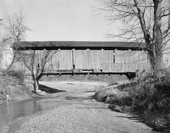
Leatherwood Station Covered Bridge is a covered bridge in Parke County, Indiana, described in its record as place in Indiana listed on National Register of Historic Places. Indiana has 103 covered bridges on record at Wayfarrow, 36 of them in Parke County.
It was built in 1899, in the late 19th century, making it the 60th oldest of the 87 in Indiana with a recorded construction date; it carries trail.
Status check, 2026-11: J.A. Britton Burr arch bridge, moved from Leatherwood Creek to Billie Creek Village on Aug 12, 1981; the county gives its size as 72 ft plus two 9 ft overhangs, so the total length is unclear. Leatherwood Station Covered Bridge is listed on the National Register of Historic Places. It stands at 39.7577° N, 87.2092° W.
Key facts
| Current structure built | 1899 |
|---|---|
| Carries | trail |
| Heritage designation | National Register of Historic Places listed place |
| National Register | Listed |
| Coordinates | 39.75766, -87.20918 |
Nearby places
- Billie Creek Covered Bridgecovered bridge · Parke County · 0.3 mi
- Beeson Covered Bridgecovered bridge · Parke County · 0.4 mi
- Crooks Covered Bridgecovered bridge · Parke County · 2.5 mi
- Catlin Covered Bridgecovered bridge · Parke County · 2.8 mi
- McAllister Covered Bridgecovered bridge · Parke County · 3.5 mi
- State Sanitorium Covered Bridgecovered bridge · Parke County · 3.8 mi
- Neet Covered Bridgecovered bridge · Parke County · 3.9 mi
- Nevins Covered Bridgecovered bridge · Parke County · 5.1 mi
- Pottertownghost town · Parke County · 5.8 mi
- Zacke Cox Covered Bridgecovered bridge · Parke County · 5.9 mi
- Phillips Covered Bridgecovered bridge · Parke County · 6.1 mi
- Mecca Covered Bridgecovered bridge · Parke County · 6.5 mi
Questions
Where is Leatherwood Station Covered Bridge?
Leatherwood Station Covered Bridge is in Parke County, Indiana, at 39.7577, -87.2092.
How many covered bridges are in Parke County?
Parke County, Indiana has 36 covered bridges on record at Wayfarrow.
- Wikidata — Wikidata item (CC0)
- National Register of Historic Places — National Register of Historic Places record (public-domain)
- Wikidata — Wikipedia article (linked as a source; text not used) (CC0)
- Wayfarrow status check (web sources) — Checked for current status (facts)
- Wayfarrow status check (web sources) — Checked for current status (facts)
- Wayfarrow status check (web sources) — Checked for current status (facts)
Facts marked "approximately" carry an uncertain date in the source. Text on this page is generated from the sources above; no encyclopedia prose is copied. Last updated 2026-11-05.